Pamukale Hierapolis Leodikea Aphrodisias Kibyra Tour
 Initial region
Denizli
 Duration
2 Days
 Language
English
 Price
€ 790 / person
- Pamukale Private Tour
- Hierapolis Private Tour
- Leodikea Private Tour
- Aphrodisias Private Tour
- Kibyra Private Tour Tour
DAY 1 Aphrodisias and Hierapolis Pamukkale Private Tour
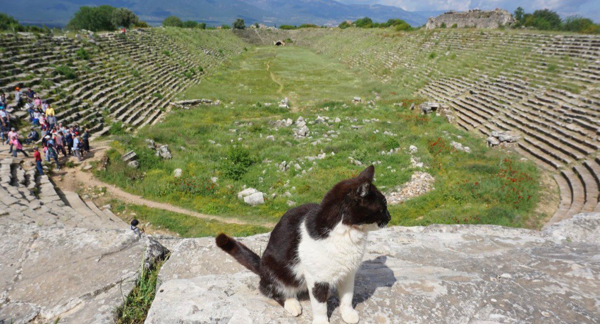
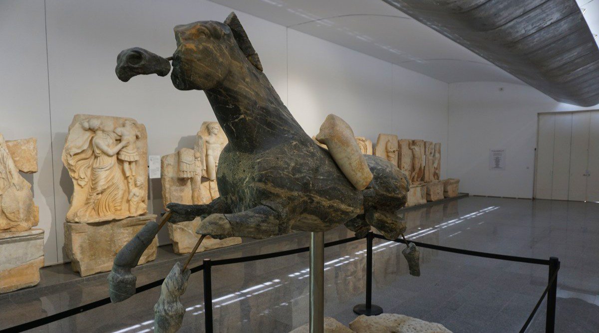
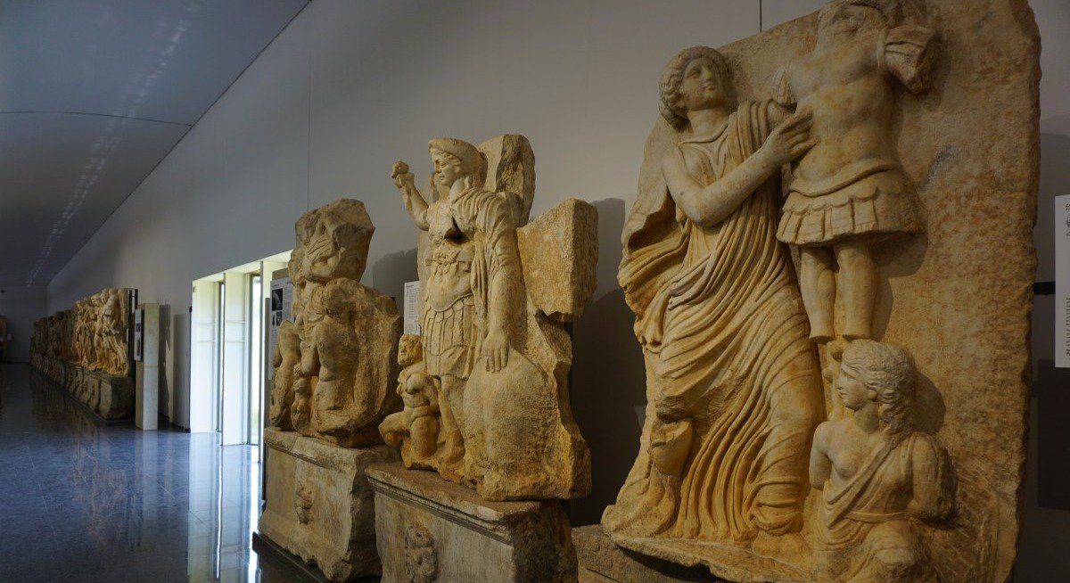
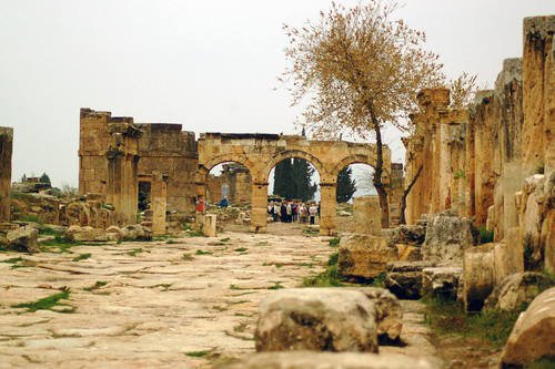
You will meet your private guide at the lobby of your hotel or airport of Dalaman or in a meeting point decided by you and drive 2,5 hours for Aphrodisias from Fethiye or towns nearby like Gocek Kas, Kalkan, Oludeniz, Antalya or Marmaris, Aphrodisias is one of the oldest sacred sites in Turkey. Dedicated to the ancient Mother Goddess and then the Greek goddess Aphrodite, it was the site of a magnificent Temple of Aphrodite and the home of a renewed school of marble sculpture. The Temple of Aphrodite later became a Christian basilica through an impressive swapping of columns. Today, the Temple of Aphrodite is well-preserved and partially restored; it is not hard to imagine its ancient splendour. Aphrodisias also offers ruins of a large theatre, a stadium and other structures, as well as an on-site museum displaying artifacts. Next see, The museum of Aphrodisias (Closed every Monday) is one of the most outstanding museums of western Anatolia. The monuments of unsurpassed value which have been found at the excavations are displayed here. Join the lunch and rest for a while then drive through to Pamukkale & Hierapolis Ancient City. When you reached to Pamukkale, you will start to visit the Necropolis, Bath and Basilica, Frontinius Gate, Frontinius Street, Northern Byzantine Gate, Fountain of the Tritons and the Temple of Apollon.
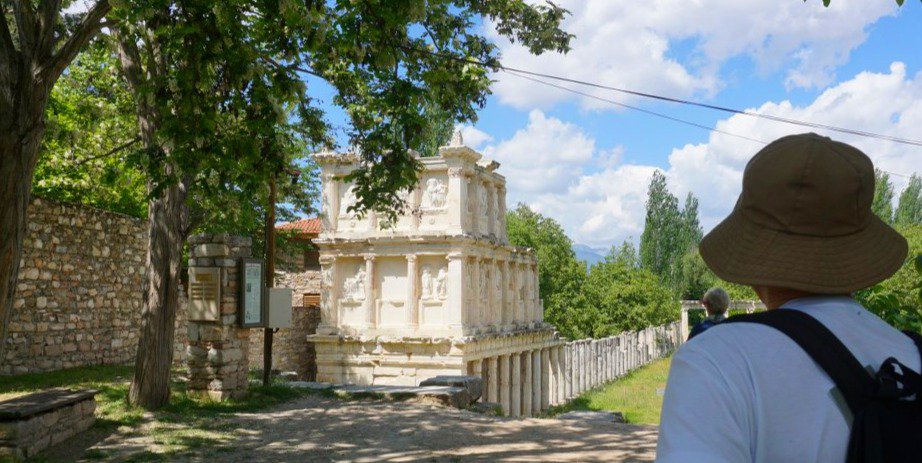
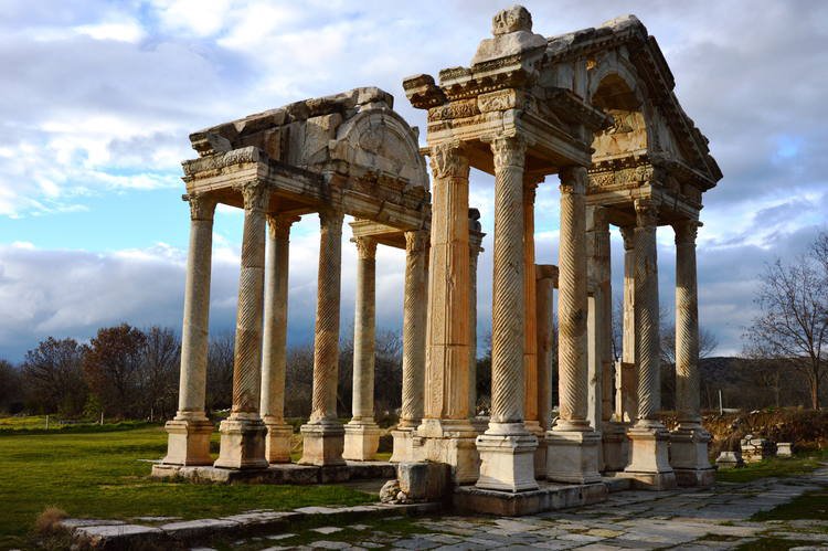
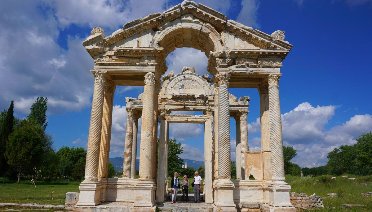
As it is very impressive Greco-Roman site of Aphrodisias, where the goddess of love once bestowed her sensual favours on her willing devotees. This site is in many ways as spectacular as Ephesus, but far quieter by comparison, and there's also an excellent museum on site that you may like to visit. The tetrapylon is a wonderfully ornate example of a huge gateway which would have once welcomed you into the main street leading to the Temple of Aphrodite. The well-preserved odeon and theatre are also well worth seeing, as is the Sebasteion, which is carved with reliefs depicted Aphrodite and her worshippers. The piece de resistance has to be the stadium which measures 270 metre long by 60 metres wide and would have held 30,000 spectators. On the seats you'll find carvings into the rock, which have been graffitied during the athletic events that took place here.
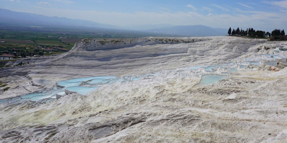
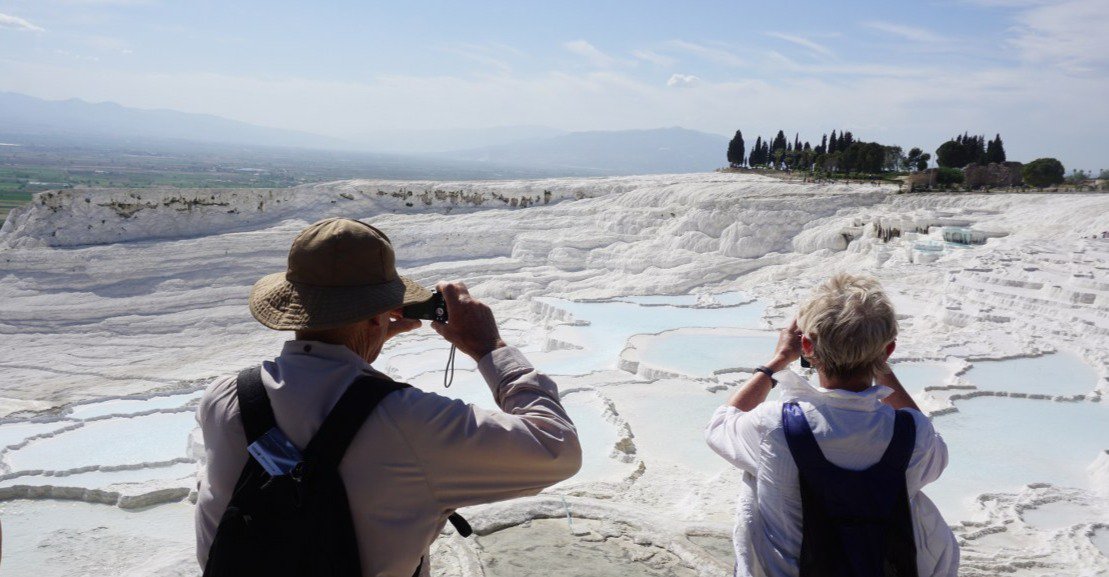
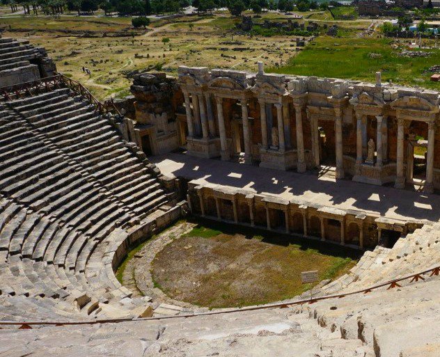
In the afternoon, we reach one of Turkey's most amazing natural wonders, the 'frozen waterfall' of Pamukkale. Situated on a high escarpment, Pamukkale has been an attraction since Roman times. Stalactites of a bright white petrified waterfalls cascade from basin to basin. We visit the incredible travertine pools, where you can opt to swim and enjoy the views overlooking the Menderes Valley. Above the terraced pools you'll find the ancient spa town of Hierapolis where the ruins date back to 2nd century BC and the time of Eumenes II. Earthquakes have rocked the area throughout history and the site was finally abandoned in 1334 following a particularly strong quake. Here you can visit the theatre, Temple of Apollo, Frontinus Gate and see a number of sarcophagi as well as having the chance to go into the Archaeology Museum housed in the former Roman baths.
After our visit we'll drive to the nearby city of Denizli to check-in to our hotel. In the city there are a range of restaurants for you to choose from this evening.
ACCOMMODATION:
Venus Hotel (or similar)
Grade: Comfortable Hotel
SINGLE ROOM AVAILABLE
SWIMMING POOL AVAILABLE
MEALS PROVIDED: DINNER
DAY 2 Laodicea Kibyra Private Tour
Archaeological site of Laodikeia
Laodikeia is located within the borders of the villages of Eskihisar, Goncalı, Korucuk and Bozburun, six km north of the modern city of Denizli. The site is on the road to Pamukkale (Hierapolis), which is approximately ten km to the north.
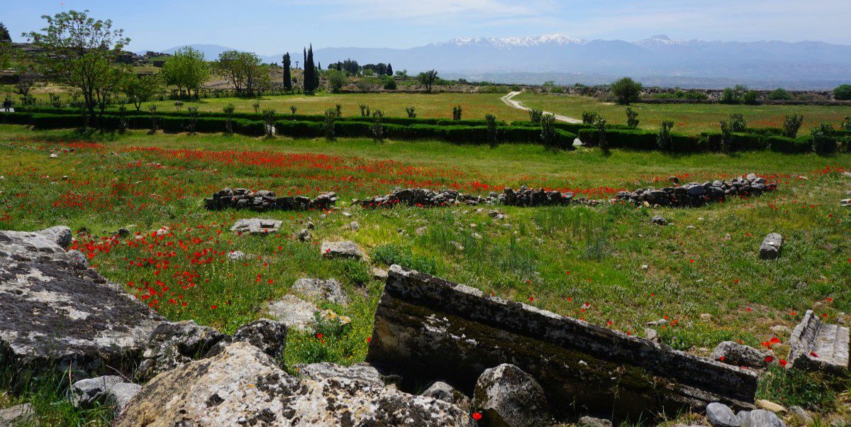
Laodikeia is also situated at the crossroads of main routes that connect western, central and southern Anatolia with each other. Set amid the fertile plains of the Lycos River, Laodikeia lies on a high plateau surrounded on three sides by rivers: the Lycos (modern Çürüksu) to the northeast, the Kapros (modern Başlıçay) to the southeast and the Asopos (modern Gümüşçay - Goncalı Deresi) to the northwest.
Laodikeia is one of the important archaeological remains for the region along with Hierapolis (Pamukkale) and Tripolis. Excavations at Laodikeia show that the city was settled continuously from the Chalcolithic Period (Copper Age, 5500 BCE) to 7th century CE. The name of the settlement was, in turn, Rhoas (Asopos Hill), Diopolis (City of Zeus) and finally Laodikeia.
The settlement was founded as a city in the Hellenistic Period. The Hellenistic city was founded by the commander Seleucus Antiochus II in the name of his wife Laodike around the middle of the third century BCE. The region later became part of the Roman Republic (after Empire) in 130-129 BCE. Throughout its history, Laodikeia suffered many earthquakes and was rebuilt numerous times. It was finally abandoned after a severe earthquake in the reign of Emperor Focas (r. 602-610 CE). Its citizens settled in Denizli - Kaleiçi and Hisarköy on the north slopes of Mt. Salbakos (modern Babadağ), after the city's abandonment. Laodikeia was one of the Seven Churches named in the Book of Revelation and later became a metropolitan city in the Early Byzantine period.
During the Hellenistic Period the city was designed on the Hippodamian grid plan where the streets cross at right angles or run parallel to each other. The golden age of the city was from the 1st to 5th centuries CE. Most of the structures and the city itself have been developed during this period.
Encompassing an area of about five square kilometres, Laodikeia boasts the following impressive remains: the largest ancient stadium of Anatolia (measuring 285 x 70m), two theatres (Western and Northern Theatres), four bath complexes (East, Central, West and East Roman baths), five agoras (East, Central, West, South and North Agoras), five fountains (nymphaea; East Byzantine, Caracalla, Septimus Severus, B and West Fountains), two monumental portals (Ephesus and Syria Gates), a council house (bouleuterion), houses with a peristyle design (House A Complexes, Peristyle House with Church), temples (Temple A), churches (East, North, West, Central, Southwest Churches and Laodikeia Church), public latrines, two large water distribution terminals and monumental colonnaded streets (Syria, Ephesus, Stadium Streets). The city is surrounded by cemeteries (necropoleis) on its four sides.
The most important income of the city was commerce, thanks to its location on the crossroads of major trade routes. The foremost trade was textiles. In addition, marble, grain and livestock commerce also provided an important income to the city
Later in the afternoon we return back home, on the way back we visit Kibyra ancient city
Ancient city of Kibyra Tour
The ancient city of Kibyra is located in township of Gölhisar on southwestern part of the province of Burdur, at a distance of ca. 110 km from the provincial center. The settlement is situated on hills just to the west of modern town. To the west of the city are broad pasturages and Akdağ mountains while the fertile plain of Gölhisar extends to the east, with the stream Dalaman running through it. The Lake Gölhisar and the Mount Koçaş to the east of the plain presents a wonderful sight from the ancient city. The surroundings of the city was located on the crossroads of Phrygian, Carian, Lycian and Pisidian cultures and of commercial routes running east-west and north-south directions. The modern Gölhisar town is similarly located on the crossroads of southwestern Anatolia, lying in a distance of 110 km. from Denizli at the northwest, 130 km from Antalya at the south and 100 km from Fethiye at the southwest.
While the meaning of Kibyra is not known, it is suggested to be of Luwian origin, the language spoken widely in the western and southwestern Anatolia beginning from the Late Bronze Age, later being converted in Hellenic tongue to its present form. Naming of the region as Kibyratis reflects its political strength. In earlier times, as Herodotus tells, the region was called Kabalia.
We get the information on people living in the region from Strabo. He tells us Kibyrians descended from Lydians and settled in Kabalis and its surroundings. At the beginning of the Hellenistic period Pisidian immigrants from Milias and Termessos moved the settlement to a well-fortified area with a perimeter of 100 stadia (ca. 19 km). Thereupon the new, multilingual (Lydian, Solymian, Greek and Pisidian) and multicultural (Kabalian and Pisidian) city of Kibyra is founded. Though Strabo does not indicate any date for the events, the first settlement seems to have been located on the rocky hills around Lake Gölhisar in modern Uylupınar Village, 18 km away from Kibyra. The remains at those hills go back to Early Iron Age and attest to a continuous occupation, which led to suggest it was the earlier settlement of Kibyrians, who are thought to move to the present city around the 4th and 3rd centuries BC. Strabo tells us the city was strengthened thanks to its powerful justice system and established a tetrapoleis federation with Boubon, Balbura and Oinoanda. Named as Kibyratis the federation granted double voting right to Kibyra while the rest had single each. Tetrapoleis was abolished by the Roman General Murena in 84-83 BC and Kibyra was included in the province of Asia, whereas other partners were annexed to the province of Lycia. Another event where Kibyra was mentioned is the earthquake that occurred in 23 AD. The remarkable damage was mitigated thanks to financial support from Tiberius, wherewith the city started to be called Caesarea Kibyra in honor of the emperor. After another earthquake badly shook the city in 417 AD, buildings couldn’t be repaired extensively as before, partly due to worsening economic conditions. Gradually shrinking, the city seems to have been abandoned in the 8th century and settlers continued to live in Horzum, the present-day Gölhisar.
The main factor defining the form of the settlement is the earthquakes. Two earthquakes among the recorded ones in ancient sources are important, one in 23 A.D. and the other in 417 A.D. The former mostly destroyed the Classical and Hellenistic early city, which was rebuilt under the architectural influence and with the support of the Rome.
Entrance to the site is provided by Savran Gut which starts from the district boundaries today. The ancient road can only easily be followed after the 200 m. inside from the gut till the monumental arch which has taken its latest form by the late Roman period repairs. On both sides of the ancient road are found necropolis area which is mostly composed of sarcophagus.
Beginning from the Monumental Arch that stresses the entrance to the city, public buildings on the main hill, namely Stadion, Basilica, Agora, Theatre, Odeion, temples, fountains and Baths are oriented to the plain and the lake in the east and positioned in a way not to curtain each other. On the northern and southern slopes of the main hill lay Roman-type villas with peristyle courtyards, which also have a good view of the landscape. Below the limestone-paved streets run sewerage lines constructed with stone masonry and a water distribution network using terracotta pipes. The sewerage system is thought to begin somewhere near the pottery workshop quarter just above the theater. A series of sewerage pipes excavated below the Stadion surface reveal how waste water from above is drained so as to protect the venue from inundation. The city seems to have not needed a strong fortification system thanks to combination of rugged high terrain and military might, on the contrary to Strabo’s account of a strong defensive wall in its earlier times.
The first surveys on the city were conducted in the 19th century by T.A.B. Spratt and E. Forbes. First excavations in the city were done in 1988 and 1989 by the Directorate of Burdur Museum on Odeion building and in the tombs cut on the southern slopes of the main hill. In 2001 and 2002 another work was conducted by the Museum on the Necropolis Way at the Main Street for clearing and salvage purposes. Besides those tentative works, an epigraphical survey has been done since 1995. The first systematic and regular excavations were started in 2006 under direction of Burdur Museum and kept by Mehmet Akif Ersoy University’s Department of Archaeology starting from the year 2010. Till today excavations exposed the Stadion, Odeion, Agora, Roman Bath Complex and Necropolis of the ancient city. Considering the fact that neighboring Oinoanda had a philosophical tradition as attested in the monumental inscription of indigenous Roman philosopher Diogenes’ thoughts, traces of a similar rhetorical tradition can be expected from Kibyra
MEALS PROVIDED: BREAKFAST & LUNCH
• Transportation with fully A/C private vehicle
• Professional and experienced licensed English speaking guide during the tour
• All local taxes and insurances
• Lunch
• Entrance fees
• Parking fees
• Highway toll
• Personal expenses on the tour
• Any gratuities for guide & driver
• Drinks
Prices
1 Pax: 245.00 €
2 Pax : 200€
3 Pax: 175€
4 Pax:150€
5-6pax: 140 €
7-9 Pax: 125 €
10-12 Pax: 100 €
This tour could be customized and we can pick you from Fethiye, Gocek, Kas, Kalkan, Dalyan, Marmaris or Antalya
Please contact us for more information
Programmes may customized and personalized due to your requests.
The cost of this tour is changeable according to your travel dates and number of your group
Please let us know your travel dates to check our private tour cost.
You can make any changes on the programe, if our programs are not suitable for you
We can work together on your itinerary


